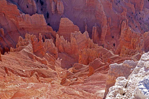
Cedar Breaks National Monument, Utah
|

|
|
Cedar Breaks National Monument, Utah [kirksnaturebooks.net]
|
Utah's early Native Americans called Cedar Breaks the "circle of painted cliffs." The circle is really a giant amphitheater whose floor is a maze of multicolored pinnacles, spires, fins, columns, and arches. It's a big commitment to walk to the depths of Cedar Breaks, but you can do it via Rattlesnake Creek Trail, a strenuous, nine-mile route that flirts with the northern boundary of the park and passes through Ashdown Gorge Wilderness Area. The trail drops 2,500 feet in four miles before it connects with Ashdown Creek, which can be followed into Cedar Breaks. Or, with a car shuttle, a hiker can continue five miles to Utah 14. Along the way stands Flanigan Arch, which rises 100 feet and spans 50 feet. This is a hike only for the fit and adventurous, although summer heat is far less a concern than in Grand Canyon because Cedar Break's rim is above 10,000 feet. Less intrepid visitors can enjoy two short rim hikes—Alpine Pond Trail leads to a great view at Chessman Overlook and to a spring-fed pond; Spectra Point/Ramparts Overlook Trail follows the south rim to a viewpoint before it passes through a stand of ancient bristlecone pines.
 0 Comment(s)
 Print
Print E-mail
nationalgeographic.com, August 17, 2011
 Add your comments...


