 0 Comment(s)
 Print
Print E-mail Xinhua, April 15, 2025
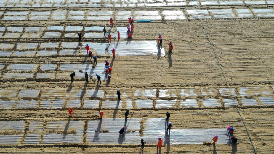
This photo taken on April 13, 2025 shows a wheat field irrigated by desalinated water in Xayar County, Aksu Prefecture, northwest China's Xinjiang Uygur Autonomous Region. The Taklimakan Desert in northwest China's Xinjiang Uygur Autonomous Region covers 337,600 square kilometers and its circumference measures 3,046 kilometers, making it the largest desert in China and the second-largest drifting desert in the world. Thanks to decades-long sand prevention and control efforts, the Taklimakan Desert was completely encircled with a sand-blocking green belt on Nov. 28, 2024. In 2025, Xinjiang aims to afforest a land area of about 796,000 hectares, including 562,666 hectares for frontline control in the Taklimakan Desert. These afforestations form a part of the Three-North Shelterbelt Forest Program, the world's largest afforestation program, which tackles desertification in northwest, north and northeast China. Meanwhile, Xinjiang will further widen the sand-blocking green belt and enhance desert-locking efforts to achieve sustainable sand control while improving local livelihoods. (Xinhua/Ding Lei)